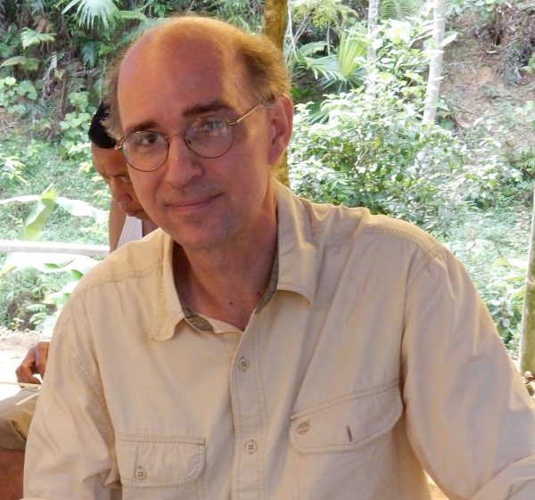
Leisz Wins Fulbright and Bound for Vietnam
Joshua Zaffos
Stephen Leisz first arrived in Hanoi, Vietnam, in 1997 to help map land uses and land-cover in the country’s mountainous areas and to train others to monitor environmental changes. Hanoi’s first traffic lights, new skyscrapers, and steady population growth of the previous decade represented Doi Moi – Vietnam’s economic “renovation” in motion. Leisz, who studies land change using geographic information systems (GIS), remote sensing, and other digital mapping and spatial-analysis tools, recognized a place to explore and study for years to come. Over the following decade, he worked as researcher, consultant and professor in Vietnam and other locations in Southeast Asia before ultimately coming to Colorado State University.
Now, Leisz, a Professor of Geography at CSU, will return to Vietnam in 2022 with a Fulbright Scholar Award to study the impacts of Vietnam’s environmental, social and economic transformations on rice-farming communities and to help train and to collaborate with Vietnamese researchers and urban and regional planners to manage the land-use changes unfolding across the country.
“This opportunity is exciting,” Leisz said, “because I will be able to reconnect and collaborate with some of my old students and trainees, who I first worked with between 1997 and 2005 and are now researchers, lecturers, and professors. I will also be able to travel to villages that were considered remote and at least an eight-hour drive to get to in 1997 and now are within an hour’s drive of Hanoi.”
The Fulbright Program, now 75 years old, is funded through the U.S. Department of State’s Bureau of Educational and Cultural Affairs and specifically supports research and international educational exchange.
Leisz’s Fulbright Award will enable him to collaborate with faculty and develop new courses at the Vietnam National University of Agriculture (VNUA) to teach and prepare the next generation of Vietnam’s land managers to use GIS and remote sensing as well as social-science methods to interact with and gather data from communities. Leisz is also preparing to lead a new Land Change Science Field School, based at VNUA in Hanoi. The course, originally slated to be taught in Summer 2020, was delayed due to COVID, but will now be taught in June 2022. The course will be taught in conjunction with VNUA lecturers; the language of instruction is English, and it will include students from CSU, VNUA, and also be open to students from other colleges in the U.S.
“I’m excited to teach this course because it will provide a cross-cultural learning and experiential research opportunity for students from the U.S. and Vietnam, since they will be in class together, and also spend time doing fieldwork together,” Leisz said. “From my experience, these types of experiences provide students with an excellent opportunity to connect across cultures and also potentially meet life-long friends from other countries.”
Urbanization and industrialization have brought wealth and prosperity to parts of Vietnam but development is also transforming and complicating agriculture. Rice-farming communities, in both mountain uplands and lowland deltas are changing. In the mountains, farmers rely on swidden cultivation, an agricultural system where swaths of land are cleared, burned, planted for one season, and then allowed to regenerate over years or decades to natural conditions. In the lowland deltas, farmers cultivate small flood-irrigated plots of rice. However, in recent years large-scale agriculture and development projects have replaced swidden with permanently cultivated mountainside cornfields and many lowland rice fields have been converted to industrial parks, upending livelihoods and social relationships and also threatening natural resources that protect water quality and wildlife habitat and reduce flood risks.
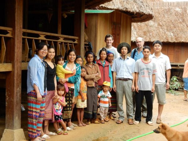
Leisz witnessed the early signs of this change during his time in Vietnam on and off through the 90s and living there from 1999 to 2007. During that time, Leisz first ran a remote-sensing lab for the East-West Center, based in Honolulu, Hawaii, and later lived in Hanoi where he did consulting work with CARE International, the global nonprofit dedicated to eliminating poverty, and as an employee of the University of Copenhagen. During this time, he developed some of the first digital maps and spatial analysis of the changes unfolding in the country’s rural areas.
“The mapping work we did in the late 1990s was so different than anything that my Vietnamese colleagues had ever done” Leisz recalled. “Previously all of the country’s maps were made based on land surveys or air photos.” The land-cover categories of the maps were the government’s official land-cover categories. This meant that swidden agriculture areas were always classified as some category of forest.
“I helped to introduce the use of GIS and satellite imagery to my colleagues, and we interpreted the land-cover based on the categories that the farmers had for their land-cover,” Leisz continued. “Because of this our maps more faithfully reflected the way the local people used the upland areas and the variety of land-cover found in the mountains which included periodically cultivated areas, regenerating fallow shrublands, regenerating tree cover, and old tree cover. These categories reflected that humans used the land, as opposed to the government categories that assumed all the mountains were covered in forest and didn’t include humans and their farming practices on the landscape.”
His work also included teaching classes at VNUA and training others in Vietnam to use GIS to compile data and analyze remote sensing data to recognize changes in land cover and uses, such as the expansion of road networks and the loss of natural areas in deltas and fallow areas in the uplands.
After Leisz completed his Ph.D. in Geography at the University of Copenhagen in 2007, he started at CSU in 2008. During this time, he stayed in contact with his colleagues in Vietnam and collaborated with them on regional research projects, while biding his time to return to Vietnam for a longer period of time.
Through the Fulbright Award, Leisz plans to develop two new courses at VNUA, the university where most of Vietnam’s resource managers and aspiring agricultural and environmental officials get their degrees. The courses, Participatory GIS and Land-Use Planning and Agricultural Transitions in Vietnam, will each draw on his expertise with GIS and spatial analysis, remote sensing and land-change science, and international development.
The courses will provide students with experiential learning and field-based research and also emphasize participatory pedagogical approaches inside and outside classrooms, Leisz said. Coursework will include training with GIS and spatial analysis to identify physical changes to landscapes as well as social-science methods to conduct qualitative interviews with farmers and others to recognize how villages and families are affected by economic changes.
Leisz hopes the classes can “help VNUA adjust its curriculum and coursework to the new reality of how rural areas are changing so that graduates are prepared to support new agricultural practices in the country and new forms of rural development.”
The award will also enable Leisz to pursue his own research and return to villages he first worked in during 1997 and see how swidden-based farming communities are adapting and changing as other factors diminish and eliminate the practice.
“Practiced correctly, swidden is favorable to conservation,” Leisz said, “because the fallow period of the cycle supports a diversity of animal and plant species that cannot coexist with permanent farming or paved-over development.”
But the expanding industrialized and more permanent forms of hillside agriculture, namely raising corn to feed livestock, do little to protect biodiversity or to store carbon. In the tropics, there is not a lot of nutrients in the soil, so it’s the trees and plants that store and regulate the land’s nutrients and water resources. “If you let the land regenerate from between 10 to 50 or 60 years” – like swidden systems in parts of Southeast Asia do – “it works well,” Leisz said. “I’ve worked with farmers who have taken me to fields worked by their grandparents that now appear similar to mature forests.”
Leisz hopes his research will offer insight into the benefits of swidden farming to store carbon, protect biodiversity, and bolster livelihoods – especially as carbon sequestration has become a priority to offset global climate change. “It’s important but it’s not being addressed,” he said.